
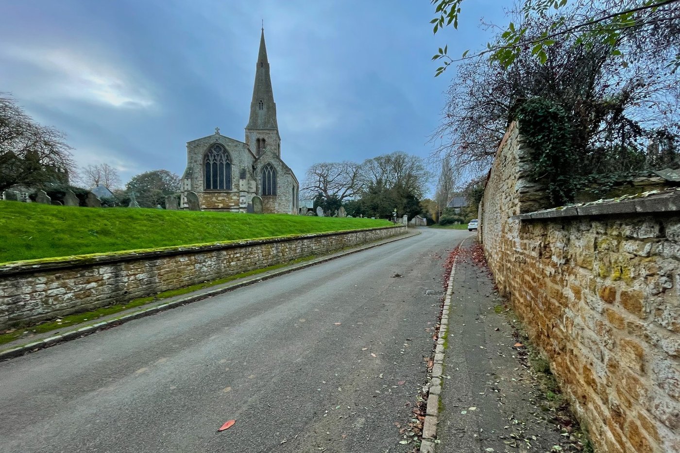
All Saints from Church Way. Photo: Philip Jeffrey, CC BY-SA 2.0.
Thorpe Malsor is a small parish two miles west of Kettering, with a church, a hall, a village hall, a social club, allotments and twelve listed buildings. It has never had much else.
The name
Thorpe is the Old Norse þorp, an outlying farm or secondary settlement. Malsor comes from the Norman family who held the manor in the twelfth century, Fucher Malesoures. In Domesday Book (opens in a new tab) the place is Alidetorp, probably “Ælida’s outlying farm”, after an Old English woman whose name has otherwise vanished. Twenty households, three ploughs, and a value of £1 10s that had not changed since 1066.
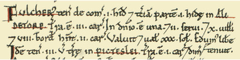
The original entry for Thorpe Malsor in the Domesday Book (1086).
Before the village
The county archaeological inventory (opens in a new tab) records a polished stone axe-hammer found in the village around 1923, now lost, and an Anglo-Saxon cemetery just south-west of the village. Ironstone working in 1910 turned up a pottery urn, and later finds from the same ground included two swastika brooches, wrist clasps, two spearheads, part of a sword and at least two skeletons. The swastika here is the ordinary Anglo-Saxon decorative motif, several centuries before it meant anything else.
Earthworks on the south side of the main street, inside the park boundary, mark where more houses once stood. They were probably cleared when the park was laid out.
The Maunsells
In 1622 a London lawyer called John Maunsell bought the manor and the impropriate rectory, which meant the family took the church’s tithes as well as its land. The estate has not been sold since. The Hall (opens in a new tab) is early seventeenth century, ironstone with limestone dressings, and got its plain ashlar south front and central bow in 1817. The gates on Eagle Lane are topped by two stone eagles.
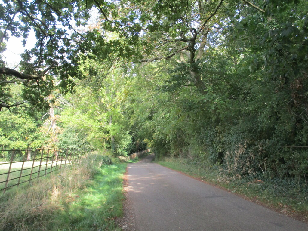
Eagle Lane, the old approach to the Hall. Photo: Jonathan Thacker, CC BY-SA 2.0.
The family’s best-documented moment came in 1650, when Maunsell agreed with the other freeholders to enclose one of the parish’s three open fields, Tobex Field. Bill Franklin’s account in Northamptonshire Past and Present 69 (opens in a new tab) follows what happened next. The enclosure quietly cost the church five acres of land whose income had paid for repairs and poor relief, about £1 15s a year. The churchwardens complained to the Lord Keeper of the Great Seal in 1680 and won. The freeholders then went to Chancery, and in December 1683 the court confirmed the enclosure, held that the church had actually gained, and left the rector his tithes. A village took on its squire, its parson and the Bishop of Peterborough, and got most of what it wanted.
Thomas Philip Maunsell, born at the Hall in 1781, was Conservative MP for North Northamptonshire (opens in a new tab) from 1835 to 1857 and colonel of the county militia. The male line ended with Major Cecil John Cokayne Maunsell in 1948, and the Hall is now home to his descendants, the Holborows. A villager who grew up here in the 1930s remembered being allowed to collect duck eggs from the lake, and being told that people once doffed their hats to the squire as he passed.
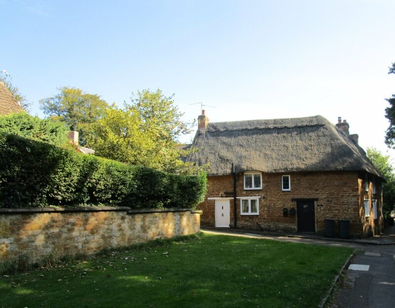
Bonnevie Cottage on Church Way. Photo: Jonathan Thacker, CC BY-SA 2.0.
Cromwell’s head
This one sounds made up and is not. When Charles II came back in 1660, Cromwell’s body was dug out of Westminster Abbey, hanged in chains and beheaded. The head spent more than twenty years on a spike over Westminster Hall before it disappeared, then turned up in the eighteenth century as a collector’s item. It sold for £180 in 1781 and £230 later, and by 1814 it belonged to Josiah Henry Wilkinson. The family kept it for the next 145 years.
In 1935 Canon Horace Wilkinson let scientists examine it. They found the skullcap had been removed and the head embalmed, exactly as the records of Cromwell’s burial described, and concluded it was genuine. The Canon told a newspaper in 1949 that he would not hand it over: “Not likely, I can look after it better than the State. When they had it, they stuck it on a pole.”
He died in 1957. His son, Dr Horace Norman Stanley Wilkinson, was the only full-time anaesthetic Senior Hospital Medical Officer at Kettering General Hospital. He inherited the head, and in 1958 he moved out of hospital accommodation and bought Laundry Cottages in Thorpe Malsor, which had once belonged to the Maunsells. For two years Cromwell’s head was kept in the village.
In 1960 he gave it to Cromwell’s old college, Sidney Sussex in Cambridge, where it was buried in the chapel. The exact spot is still secret. Chris Smart’s account in the Cromwell Association’s Protector’s Pen (opens in a new tab) argues that Dr Wilkinson, rather than being a passive custodian, was the reason the head was finally laid to rest. The Northamptonshire Telegraph (opens in a new tab) tells the same story more briefly.
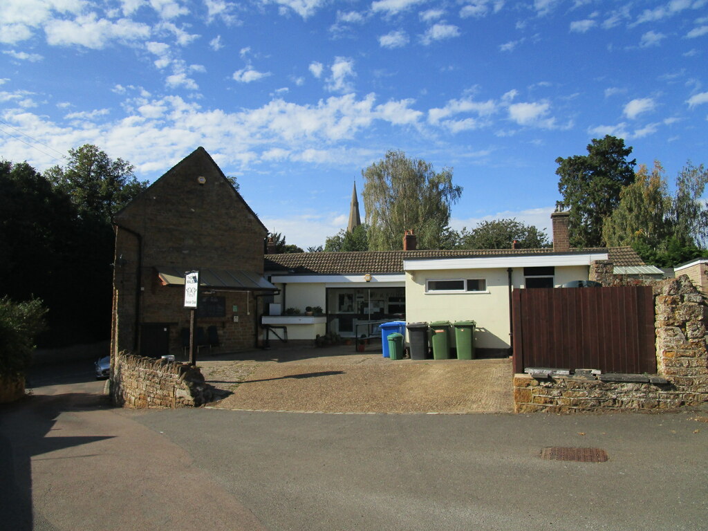
The social club. The painting in the pool room shows Laundry Cottages. Photo: Jonathan Thacker, CC BY-SA 2.0.
The village has a Civil War link of its own. In 1649 the head of the Maunsell family, John, was a Lieutenant for Cromwell, and in 1655 Major-General William Boteler described him to Thurloe, the Protectorate’s secretary of state, as “a great asserter of the present government”. The family later supplied the ironstone for Kettering General Hospital when it opened in 1897, which is the hospital where Dr Wilkinson worked. The whole chain is a coincidence too neat to invent.
The church
All Saints (opens in a new tab) is late thirteenth and fourteenth century: a four-stage tower with an octagonal broach spire, a clerestoried nave, aisles, and a chancel with a Decorated east window. Nineteenth-century directories call it St Leonard, and both names still circulate. Clapton Crabb Rolfe restored it in 1877, adding the south porch, sacristy and Lady chapel, with carving by Harry Hems of Exeter. The bells are a ring of six; the tenor and two others were cast by the Bagleys in 1680, the same year the parish accounts record a bell being recast for £24.
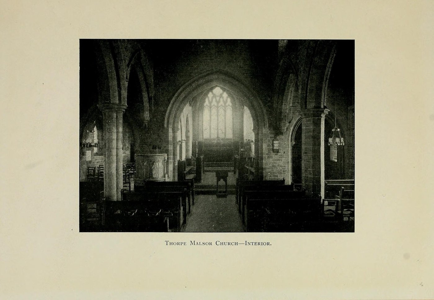
The interior photographed for R. G. Maunsell’s family history, c. 1900. Public domain.
The organ is the thing to see. It is by Thomas Casson (opens in a new tab), built in the 1880s, and Paul Hale describes it as much the most spectacular nineteenth-century organ in any English village church. Sixteen-foot painted pedal pipes stand in towers either side of the console, and the casework carries stencilled figures and panels of Pre-Raphaelite angels. It was too big for the east end, which is why it ended up wedged into the tower arch. By 2000 it was barely playable; Wood of Huddersfield (opens in a new tab) restored it in 2010 and it now holds a Historic Organ Certificate. The full specification (opens in a new tab) is on the National Pipe Organ Register.
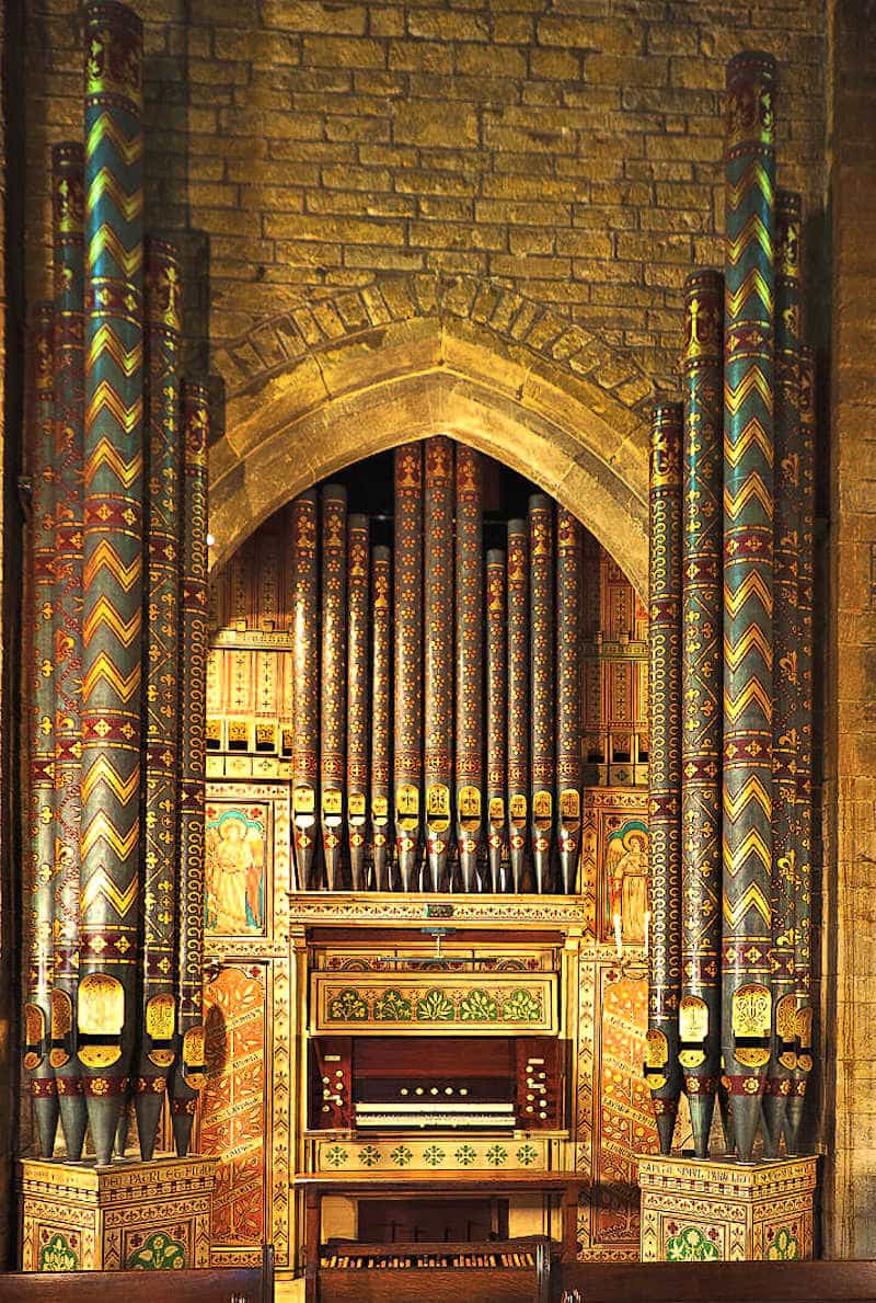
The Casson organ at the west end. Photo: Paul Hale, paulhale.org.
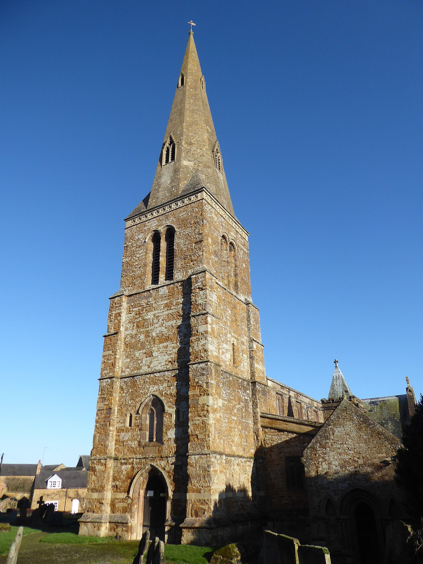
The broach spire. Photo: Dave Kelly, CC BY-SA 2.0.
The parish now belongs to the Tresham Benefice (opens in a new tab) with Rothwell, Rushton, Glendon, Pipewell and Loddington.
The well
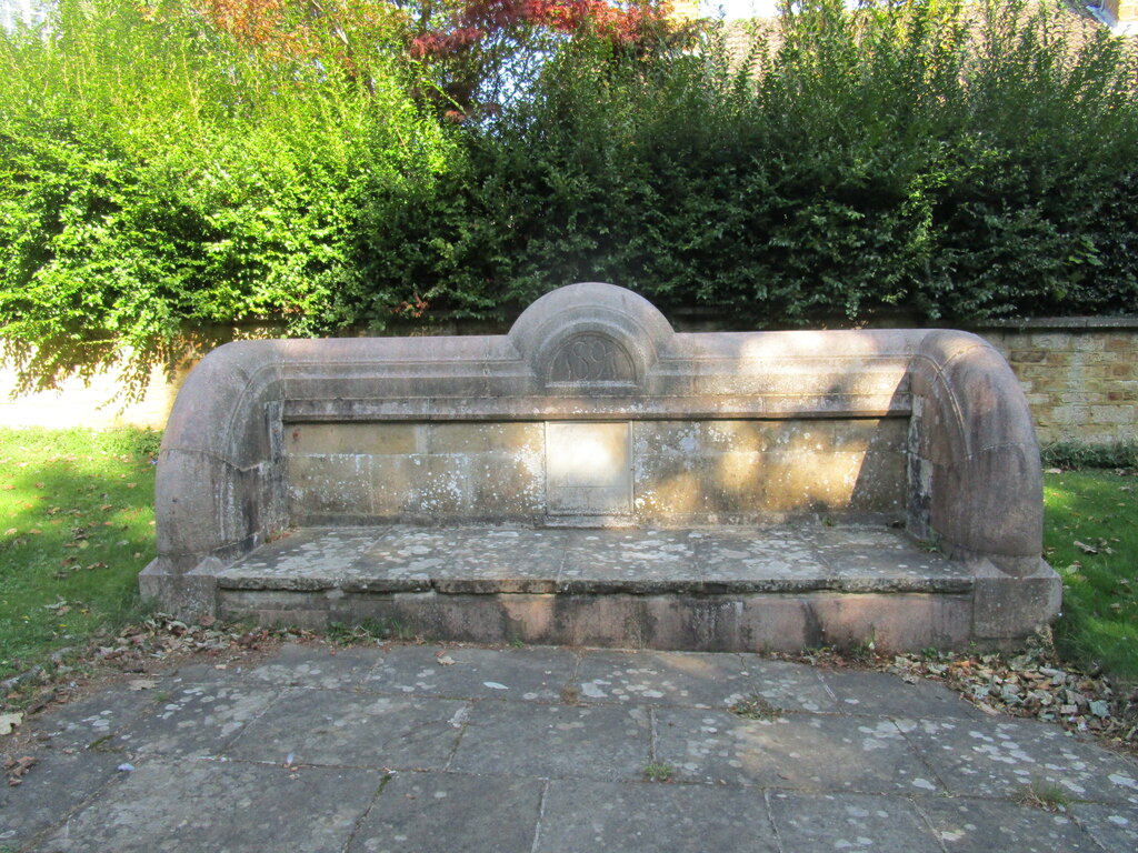
The well and its stone seat, in the middle of the main street. Photo: Jonathan Thacker, CC BY-SA 2.0.
In the middle of the main street is the village well, sunk in 1589 and now a low stone seat. It carries a Greek inscription, ΤΩ ΘΕΩ ΠΡΟΣΚΥΝΗΣΟΝ, “worship God”, with Ann: Dmi and the date. Nobody has explained it properly. The usual guess is thanksgiving after the Armada, but that is a guess. There cannot be many English villages with a Greek inscription on the well, and children have been climbing on this one for generations.
Ironstone and water
The parish sat on workable ironstone, and between the early 1900s and 1949 the north and west sides of the village were quarried. Ore went to the Kettering furnaces on a three-foot gauge tramway, part of the Kettering Ironstone Railway (opens in a new tab), which crossed the valley below the village on a substantial viaduct. The company bought a double-ended Sentinel steam locomotive (opens in a new tab) in 1926, two four-wheel units coupled cab to cab with a boiler at each end. It was underpowered, went back to the makers in 1928, and never really worked. The pits closed and the branch was lifted in 1949.
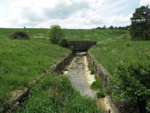
The dam at Thorpe Malsor Reservoir. Photo: Richard Williams, CC BY-SA 2.0.
Water came next. Cransley Reservoir, known locally as Three Chimneys, supplied Kettering from the 1890s. Thorpe Malsor Reservoir was authorised by the Kettering Urban District Water Act of 1901 (opens in a new tab), engineered by James Mansergh, and both are now private fishing waters.
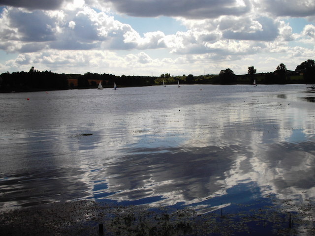
Cransley Reservoir, or Three Chimneys. Photo: James Haynes, CC BY-SA 2.0.
The wars
The church’s 1921 memorial carries six names, all from the first war: Frederick and Frank Blackwell, Walter Earl, Frederick Goodman, Albert Rickards and Charles Smart. The Roll of Honour (opens in a new tab) has full service details and quotes the local paper. Fred Blackwell was captain of the village football team and died in October 1914; his brother Frank was killed ten months later. Albert Rickards was the son of the Head Gardener at the Hall and grew roses and carnations. In the second war the village took evacuated children, and one of them came back afterwards to marry a local girl.
The village since
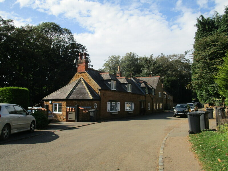
Ironstone cottages on bin day. Photo: Jonathan Thacker, CC BY-SA 2.0.
The hall stopped being the school, the quarries closed, and the estate stopped being the centre of everything. Kelly’s Directory for 1898 (opens in a new tab) records 141 people, a school in part of the village hall built in 1869, and the rector as lord of the manor and principal landowner. In 1870 there were 55 houses. In 2021 there were 55 households and 140 people (opens in a new tab), with a mean age of 49.6. The village has not changed size in a century and a half, only in who lives here.
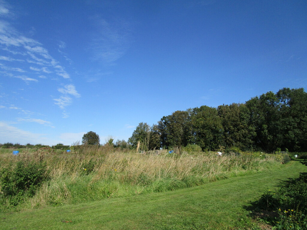
The allotments off Short Lane. Photo: Jonathan Thacker, CC BY-SA 2.0.
The conservation area was designated in 1982 and covers about nine hectares (see the record (opens in a new tab)). The county list (opens in a new tab) runs to twelve buildings, from the church down to the pigeoncote and the ha-ha.
A few numbers still don’t agree. Population figures for the 1840s and 50s vary between sources, enclosure is dated 1771 in one place and 1777 in another, and quarrying starts in either 1903 or 1913. Worth checking against the record office before anyone prints them on a noticeboard.
Image credits
| Image | Photographer | Source |
|---|---|---|
| All Saints from Church Way | Philip Jeffrey | Geograph 7921221 (opens in a new tab) |
| The tower and spire | Dave Kelly | Geograph 6370950 (opens in a new tab) |
| The well and stone seat | Jonathan Thacker | Geograph 6663067 (opens in a new tab) |
| Eagle Lane | Jonathan Thacker | Geograph 6663095 (opens in a new tab) |
| Bonnevie Cottage | Jonathan Thacker | Geograph 6663069 (opens in a new tab) |
| Social club | Jonathan Thacker | Geograph 6620226 (opens in a new tab) |
| Ironstone cottages | Jonathan Thacker | Geograph 6662724 (opens in a new tab) |
| Allotments | Jonathan Thacker | Geograph 6662725 (opens in a new tab) |
| Thorpe Malsor Reservoir dam | Richard Williams | Geograph 438958 (opens in a new tab) |
| Cransley Reservoir | James Haynes | Geograph 1095148 (opens in a new tab) |
| Church interior, c. 1900 | R. G. Maunsell, History of the Family of Maunsell | Wikimedia Commons (opens in a new tab) |
| The Casson organ | Paul Hale | paulhale.org (opens in a new tab) |